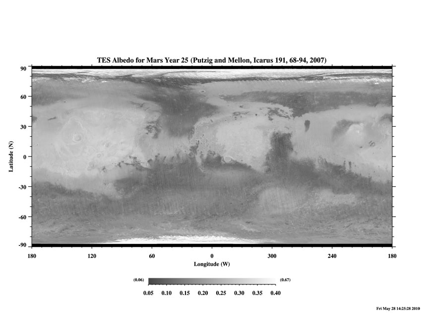
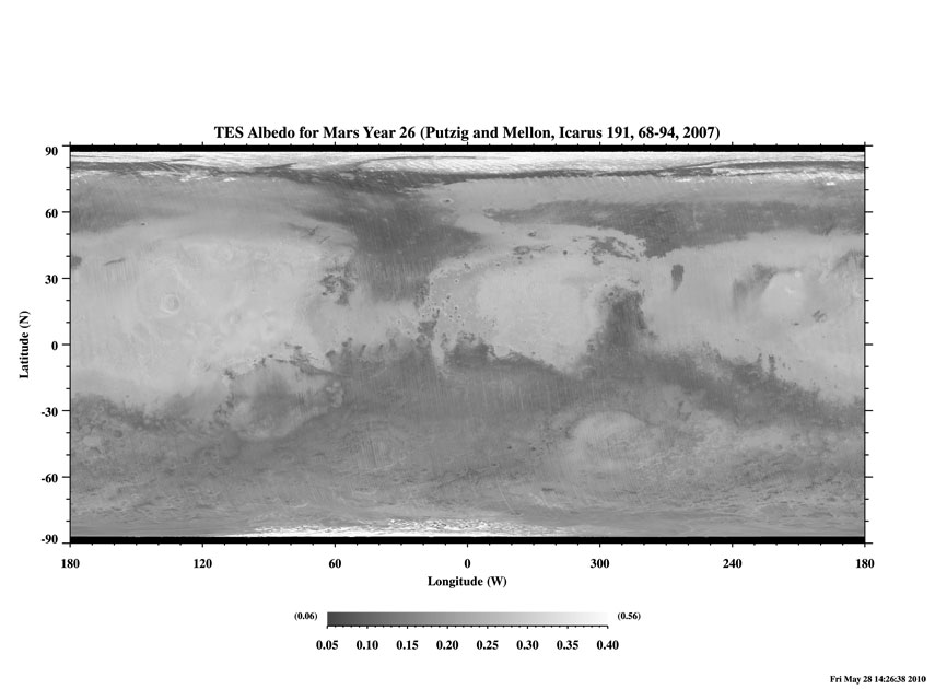
This site contains downloadable albedo maps derived from Mars Global Surveyor Thermal Emission Spectrometer observations of the surface of Mars taken over three Mars-years from orbit 1583 to 24346. See note below for proper referencing.
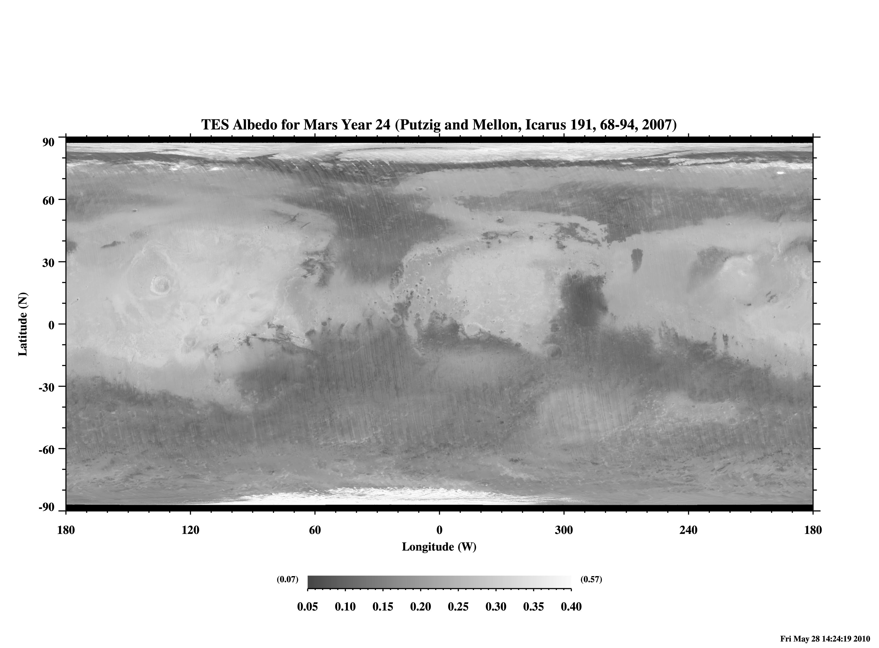
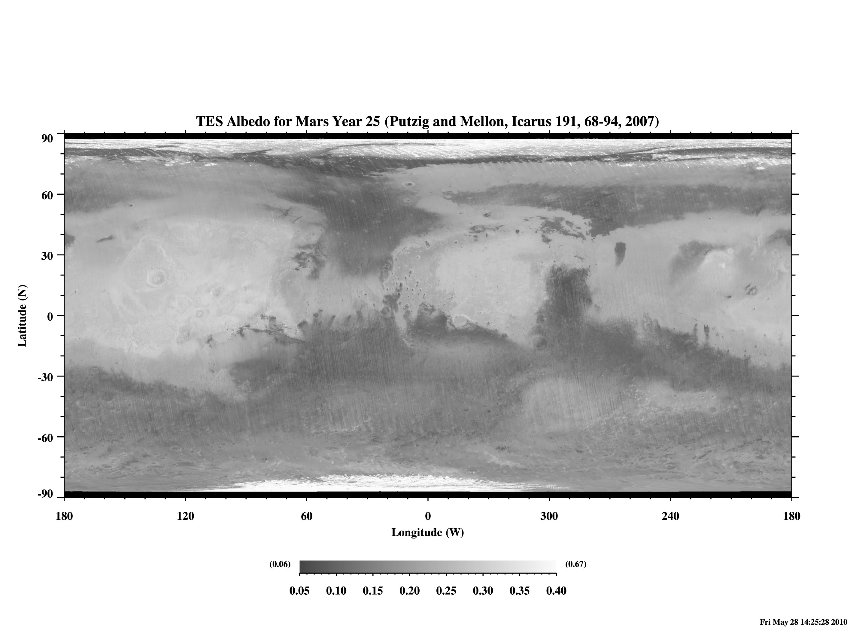
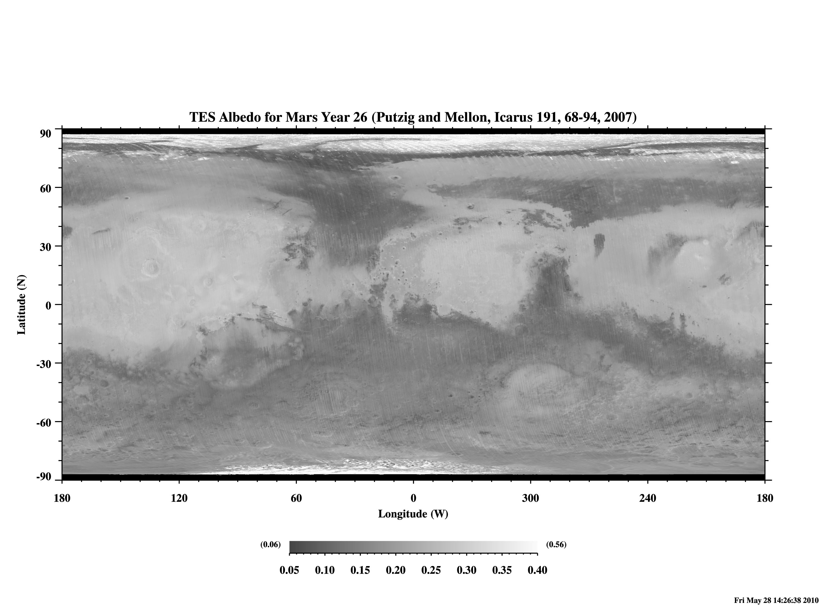
In constructing the 2007 maps of thermal inertia, it was found that large changes of albedo had occurred during the course of the mission, most notably between different Mars Years (MY). Consequently, we found it necessary to create three separate global maps of albedo in order to derive the best possible values of apparent thermal inertia. Each map has been infilled between 87 degrees south and 87 degrees north latitude. An interpolation mask is provided for each map which identifies those pixels where the map has been infilled by interpolation. If the interpolated pixels are not desired for your application, remove them by multiplying the albedo map by the associated interpolation mask.
MY24 MAP DATA MY25 MAP DATA MY26 MAP DATA (50 MB BINARY) MY24 LARGE IMAGE MY25 LARGE IMAGE MY26 LARGE IMAGE (2.3 MB JPEG) MY24 SMALL IMAGE MY25 SMALL IMAGE MY26 SMALL IMAGE (0.3 MB JPEG) MY24 INTERP. MASK MY25 INTERP. MASK MY26 INTERP. MASK (25 MB BINARY) 34.2% 39.9% 49.6% (PERCENT GLOBAL COVERAGE) Specifications:
- 20 pixel per degree resolution
- displayed albedo range is 0.05 to 0.40; higher and lower values may occur in the binary files
- includes data from orbits 1583-24346, Feb 1999 (beginning of the mapping mission) to Apr 2004
- binary map format:
14400-byte ASCII header
7200 x 3600 two-byte integer format (0 to 10000 [null=0], multiplier=10000, offset=0)
created on a SUN Blade 1500 running Solaris for those concerned with byte swapping- binary mask format:
7200-byte ASCII header
7200 x 3600 one-byte integer format (0 or 1, multiplier=1, offset=0)
created on a SUN Blade 1500 running Solaris for those concerned with byte swappingExample: If you are using IDL, you can read the binary albedo files via
OPENR,1,'AlbMY24map.bin'
OPENR,2,'AlbMY24msk.bin'
A = ASSOC(1,INTARR(7200,3600),14400)
B = ASSOC(2,BYTARR(7200,3600),7200)
MAP_INT = FLOAT(SWAP_ENDIAN(A[0],/SWAP_IF_LITTLE))/10000
MAP_NOINT = MAP_INT*SWAP_ENDIAN(B[0],/SWAP_IF_LITTLE)Please cite the following article, in which the MY26 albedo map and its difference from the MY24 map appear as Figure 3:
Putzig, N. E., Mellon, M. T., 2007. Apparent thermal inertia and the surface heterogeneity of Mars, Icarus, 191, 68-94, doi: 10.1016/j.icarus.2007.05.013.
Contact:
Nathaniel E. Putzig
Planetary Science Institute
1546 Cole Blvd., Suite 120
Lakewood, CO 80401
nathaniel @ putzig.com
Tel: 720-549-8836